
Laser Scanning & As-Built Services
from Southern California
Point Capture offers laser scanning and as-built modeling solutions
Point Capture is a small business located in Los Angeles, California, specializing in laser scanning and as-built services, both 2D and 3D.
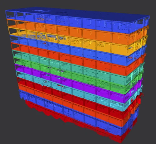
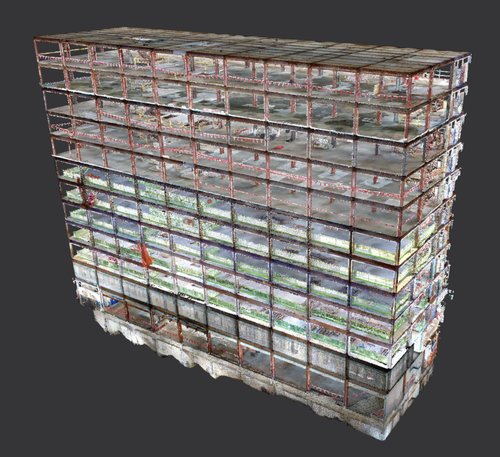
Using a NavVis VLX mobile LiDAR scanner and terrestrial laser scanners, we create high-density point clouds and 360-degree panoramic images. These point clouds and images are utilized for various services in the AEC (Architecture, Engineering, and Construction) and film industries.
Laser Scanning & As-Built Modeling Services
-
As-Built 3D Model
Point Capture will perform a detailed scan of your building and utilize the resulting point cloud to create a comprehensive 3D model. Our team will accurately model architectural elements, exposed structures, and MEP (Mechanical, Electrical, and Plumbing) systems.
-
As-Built 2D Plans
Point Capture will perform a comprehensive scan of your facility and utilize the resulting point cloud to develop accurate as-built floor plans.
-
Lidar Scanning
Using our mobile LiDAR scanner, we will conduct a detailed scan of your project site. This mobile scanner is approximately 10 times faster than a terrestrial scanner while maintaining the same level of accuracy. The deliverables include a point cloud and 360-degree panoramic images of the project.
-
Virtual Tour
The 360-degree panoramic images and point cloud are hosted on a dedicated website, allowing you and your project team to easily access them. This platform provides a great solution for remote project teams to collaborate and review existing conditions.
-
Construction Progress Scanning
Using a mobile scanner, Point Capture will take 360-degree images and perform a LiDAR scan of your construction site. The images and point cloud are accessible to project team members and stakeholders via a web browser.
-
Construction Verification
Point cloud data is compared to a Navisworks model to identify discrepancies between the installation and design. This process helps in identifying conflicts and changes as they occur during installation.
-
Property Management
Provide virtual tours to potential tenants, complete BOMA leasable square footage calculations and train personnel with a digital replica of your facility.
Locations We Serve
Our team in located in Southern California and from here we serve markets in the Western United Stated including California, Washington, Oregon, Utah, Arizona, Colorado, Texas and Nevada.
Workflow
-
We work closely with you to define project goals, deliverables, and timelines. Our team meticulously reviews plans and coordinates access requirements, ensuring seamless preparation for the scanning process.
-
Our state-of-the-art equipment scans your project site, creating high-accuracy point clouds and immersive 360° panoramic images, capturing every detail with precision.
-
The point cloud is used to develop 2D plans or a 3D BIM. Disciplines typically included are architectural, exposed structural and MEP.
-
Tailored to your project's unique requirements, our deliverables range from hosted point clouds and images with customizable team access permissions to comprehensive BIM models, 3D meshes, and 2D plans. For enhanced client engagement, we can integrate the site model into your website. Plus, all data files are available for download and future use, ensuring you have lasting resources at your disposal.
Contact Us
Phone: (310) 403-5382
Email: info@ptcapture.com